



Table of Contents Show
AI site analysis tools help landscape architects evaluate terrain, sun exposure, wind patterns, vegetation, and drainage data in minutes rather than weeks. These platforms pull from satellite imagery, GIS databases, and environmental sensors to produce layered site reports that feed directly into the design process.
Landscape architecture projects live or die by the quality of their site analysis. Soil conditions, slope gradients, microclimate patterns, stormwater flow, and existing vegetation all shape what a design can realistically achieve. Traditionally, gathering this data meant weeks of field surveys, manual GIS mapping, and consultant reports. AI-powered site analysis tools compress that timeline by automating data collection, layering multiple environmental datasets, and generating visual outputs that designers can act on immediately.
This guide covers seven platforms that address different stages of the landscape architecture workflow, building on the broader shift toward AI in architecture design. Some focus on early feasibility and environmental simulation. Others handle vegetation identification, topographic modeling, or stormwater analysis. The goal is to match each tool to the project phase where it delivers the most value.

What Makes a Good AI Site Analysis Tool for Landscape Architecture?
Not every site analysis tool works well for landscape-specific projects. Architects designing buildings care mostly about massing, daylight, and structural loads. Landscape architects need tools that handle ground-level conditions: soil types, plant health, water movement, slope stability, and seasonal microclimate shifts.
A useful AI site analysis tool for landscape work should pull data from multiple sources (satellite imagery, LiDAR, weather stations, municipal GIS portals) and present it in layers that can be exported to CAD or BIM software. Speed matters, but accuracy matters more. A tool that generates a quick sun exposure map is only valuable if the underlying solar data reflects actual local conditions rather than generic approximations.
💡 Pro Tip
Before committing to any AI site analysis platform, run it on a project you have already completed manually. Compare the AI-generated terrain, drainage, and sun exposure outputs against your field-verified data. This benchmark test reveals accuracy gaps far more clearly than demo videos or feature lists.
Integration is another key factor. If a tool produces beautiful analysis diagrams but cannot export to DXF, DWG, or shapefile formats, it creates extra work rather than saving time. The best AI tools for architects and landscape professionals connect directly to production software like AutoCAD, Rhino, Revit, or QGIS.
Autodesk Forma: AI-Powered Environmental Simulation
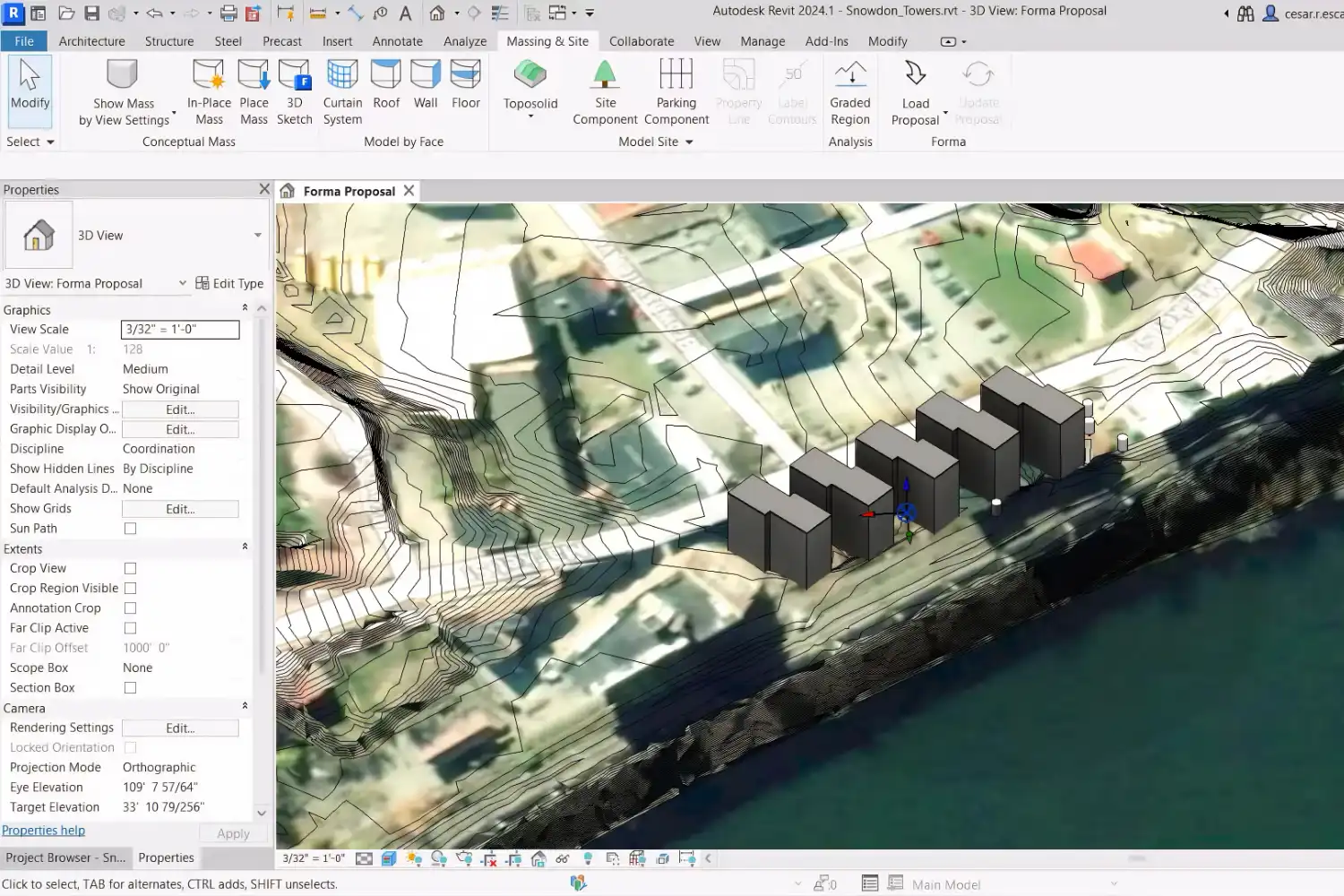
Autodesk Forma (formerly Spacemaker) is the most established AI platform for early-stage site analysis in architecture and landscape design. It runs entirely in the browser and provides real-time analysis of sun hours, wind comfort, noise levels, microclimate conditions, and embodied carbon. For landscape architects, the sun hours and wind analysis features are particularly relevant because they directly affect planting decisions, outdoor comfort zones, and hardscape placement.
Forma’s wind analysis uses machine learning to deliver near-instant predictions that are comparable in accuracy to full computational fluid dynamics (CFD) simulations. The microclimate tool combines sun, wind, and local weather data to map perceived temperature across outdoor spaces, which is exactly the kind of information landscape architects need when designing public parks, plazas, or campus landscapes. The platform also includes terrain editing tools through its Terrain Pad feature, allowing designers to model cut-and-fill scenarios and see mass balance calculations immediately.
Pricing starts at approximately $185 per month for the standalone Forma Site Design subscription. If your firm already subscribes to the Autodesk AEC Collection, Forma Site Design is included at no extra cost. Students and educators get free access through Autodesk’s education program.
🎓 Expert Insight
“Across all our AI use cases, the primary function is to augment our teams and streamline our operations. People are at TBG because they are creatives who want to create.” — Bill Odle, ASLA, President of TBG Partners
Odle’s perspective reflects a broader shift in landscape architecture firms toward using AI for data-heavy tasks like site analysis, freeing designers to focus on creative problem-solving and client relationships.
QGIS with AI Plugins: Open-Source GIS for Detailed Site Mapping
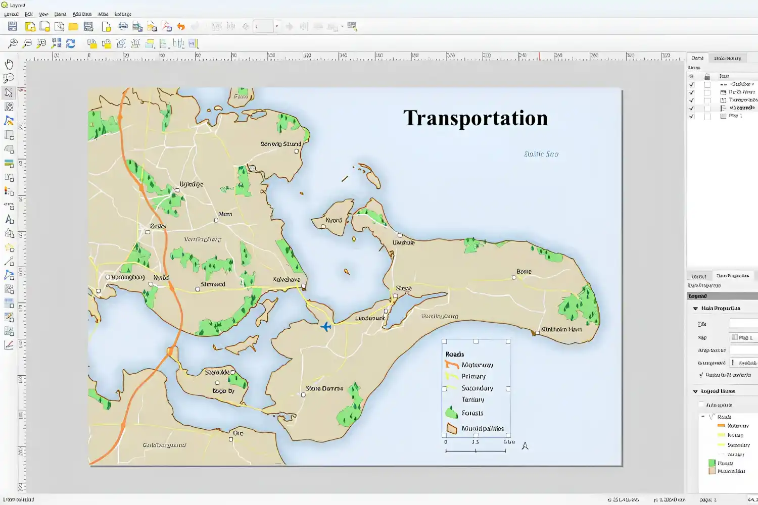
For landscape architects who need full control over their spatial data, QGIS remains the most flexible free site analysis tool available. It is an open-source geographic information system that handles topographic analysis, watershed delineation, viewshed studies, slope mapping, and land cover classification. What makes it relevant in 2026 is the growing library of AI-powered plugins that automate tasks like vegetation classification from satellite imagery, predictive flood modeling, and soil type mapping.
The learning curve is steeper than cloud-based alternatives. QGIS requires downloading and installing the software, configuring data sources, and learning its interface. But the payoff is unmatched customization. You can layer municipal zoning data, import LiDAR point clouds for precise elevation models, run hydrological analysis for stormwater planning, and export everything to CAD-compatible formats. For firms handling large-scale landscape projects like parks, campuses, or ecological restoration sites, QGIS with AI-assisted analysis plugins is hard to replace. Some landscape architects also connect QGIS outputs to parametric design tools like Grasshopper, feeding terrain and hydrology data directly into algorithmic design workflows.
How Do AI Site Analysis Tools Handle Vegetation and Ecology Data?
One area where AI is making a measurable difference for landscape architects is vegetation mapping. Traditional plant surveys require walking the entire site, identifying species, and recording locations by hand. AI tools now process high-resolution satellite or drone imagery to classify vegetation types, estimate canopy coverage, identify stressed or diseased trees, and map root zone extents. This kind of data is essential for preservation planning, where local regulations may require protecting specific trees or habitat areas.
Platforms like Esri’s ArcGIS Living Atlas provide pre-processed land cover datasets that landscape architects can overlay with their site plans. Other tools use computer vision algorithms trained on regional plant databases to identify species from aerial photos. The accuracy varies, and ground-truthing remains necessary for critical ecological assessments. But as a starting point for large sites, AI-driven vegetation analysis saves days of fieldwork. For a related look at how AI handles the visual side of architecture projects, see the comparison of AI tools for architectural visualization.
⚠️ Common Mistake to Avoid
Many designers treat AI-generated site analysis outputs as final data without cross-checking against local conditions. Tools like Autodesk Forma rely on the accuracy of your zoning and environmental inputs. Incorrect setback values or missing local wind data will produce flawed results. Always validate AI analysis against on-site observations and local planning authority records before presenting to clients.
Google Earth Engine: Satellite-Based Landscape Analysis at Scale
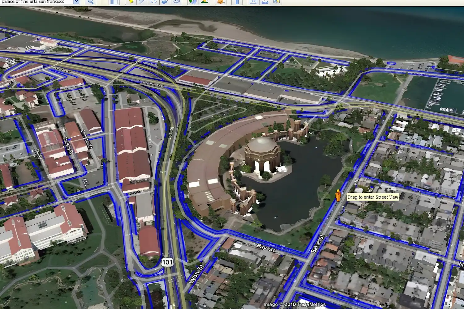
Google Earth Engine provides access to decades of satellite imagery and geospatial datasets, making it a powerful free site analysis tool for landscape architects working on regional-scale projects. Its cloud-based processing platform lets you analyze land cover change over time, track seasonal vegetation patterns, monitor water bodies, and assess urban heat island effects across entire districts or watersheds.
For landscape architecture firms involved in ecological restoration, urban greening strategies, or climate adaptation planning, Earth Engine offers data depth that standalone design tools cannot match. You can compare satellite images from different years to understand how a site’s vegetation, water flow, and land use have changed. The platform requires some familiarity with JavaScript or Python scripting for custom analyses, though pre-built apps and community scripts lower the barrier for common tasks like NDVI (vegetation health index) mapping.
Comparison of Top AI Site Analysis Tools
The following table summarizes key differences between the most relevant platforms for landscape architecture site analysis:
| Tool | Best For | Price | Key Landscape Features |
|---|---|---|---|
| Autodesk Forma | Early-stage site planning | ~$185/mo or AEC Collection | Sun, wind, microclimate, terrain editing |
| QGIS + AI Plugins | Detailed GIS analysis | Free (open-source) | Topography, hydrology, land cover, viewshed |
| Google Earth Engine | Regional-scale analysis | Free for research/non-commercial | Satellite imagery, vegetation health, land cover change |
| Esri ArcGIS | Enterprise-level spatial analysis | Subscription (varies) | Living Atlas data layers, 3D analysis, stormwater |
| Lands Design (Rhino plugin) | Landscape-specific BIM | ~$795 perpetual license | Plant database, terrain modeling, irrigation |
| DroneDeploy | Drone-based site surveys | From $499/mo | Orthomosaics, elevation models, plant health maps |
| Morpholio Trace | Conceptual site sketching | Free / Pro $9.99/mo | AR site overlay, scaled drawing, GPS integration |
DroneDeploy: AI-Processed Aerial Site Surveys
Drone technology has changed how landscape architects collect site data, and DroneDeploy is one of the leading platforms for processing that aerial data with AI. The platform turns raw drone footage into orthomosaic maps, digital elevation models, 3D terrain reconstructions, and plant health overlays. For landscape projects involving large or difficult-to-access sites, drone surveys paired with AI processing deliver topographic accuracy within centimeters.
The plant health analysis feature uses multispectral imaging to detect vegetation stress that is invisible to the naked eye. This is particularly useful for projects involving existing mature trees that need to be preserved, golf course renovations, or agricultural landscape conversions. DroneDeploy also supports volumetric measurements for earthwork calculations, helping landscape architects estimate cut-and-fill quantities directly from aerial survey data. Once the topographic model is ready, many firms move into space planning using AI floor plan tools to test building and pavilion layouts against the surveyed terrain.
💡 Pro Tip
When using drone-based site analysis, fly your survey during overcast conditions to avoid harsh shadows that distort elevation models and vegetation health readings. Schedule flights at the same time of day if you plan to compare multiple survey dates, since changing sun angles affect multispectral data consistency.

What Should Landscape Architects Look for in a Free Site Analysis Tool?
Budget constraints are real, especially for smaller landscape architecture firms and solo practitioners. Several capable site analysis tools are available at no cost, though each comes with trade-offs. QGIS provides the deepest analytical capability for free but requires technical skill. Google Earth Engine offers unmatched satellite data access but needs scripting knowledge for custom analysis. Morpholio Trace works well for on-site conceptual analysis with GPS-based overlays and AR features, but it focuses on sketching rather than data-heavy environmental analysis.
The most practical approach for firms on a budget is to combine free tools rather than searching for one platform that does everything. Use Google Earth Engine for initial site context and historical land cover analysis. Run detailed site analysis in QGIS for topography, drainage, and slope studies. Then bring those layers into your design software for the actual planning work. This combination costs nothing and covers most of the analytical ground that paid platforms offer.
How AI Is Changing the Landscape Architecture Site Analysis Workflow
The shift from manual to AI-assisted site analysis is not just about speed. It changes what landscape architects can realistically evaluate during the early design phases. A decade ago, running a detailed wind analysis for an outdoor space required hiring an environmental consultant and waiting weeks for CFD simulation results. Now, platforms like Autodesk Forma produce comparable wind comfort predictions in under a minute. That speed difference means designers can test multiple site configurations against environmental performance rather than committing to a single layout and hoping the analysis confirms it later.
AI also helps landscape architects handle larger datasets than would be practical manually. A stormwater management study for a 50-acre campus, for example, might involve analyzing elevation data from LiDAR scans, soil permeability maps from USDA databases, historical rainfall data, and existing drainage infrastructure plans. AI tools can ingest all of these layers simultaneously and produce runoff predictions that would take a human analyst days to calculate. Firms that adopt these tools report significant reductions in pre-design timeline, with some tasks moving from 40 hours to under 4 hours.
📌 Did You Know?
According to a 2026 survey by the American Society of Landscape Architects (ASLA), AI adoption is increasingly affecting client relationships, with clients now expecting firms to reduce project quotes and increase speed through AI tools. Respondents at multidisciplinary firms reported substantially higher AI usage than those at landscape-architecture-only practices.
The connection between site analysis and parametric design is also growing. Environmental data from AI site analysis can feed directly into parametric models in Grasshopper or Dynamo, allowing landscape architects to generate grading plans, planting layouts, or hardscape patterns that respond to actual site conditions rather than generic assumptions. This data-driven approach to landscape design produces results that are both more defensible to clients and more likely to perform well after construction.

Video: AI-Powered Site Analysis Mapping for Architecture and Landscape Design
This video from landscape architecture educator Nano Banana demonstrates how AI-powered mapping tools can generate detailed site analysis diagrams from text prompts, covering terrain, vegetation, circulation, and environmental layers in minutes.
Final Thoughts
AI site analysis tools are practical, available now, and already changing how landscape architecture firms approach pre-design work. The best approach is not to find one tool that replaces your entire workflow, but to identify which platform fills the biggest gap in your current process. If you spend too much time on early environmental analysis, Autodesk Forma is the strongest option. If you need better terrain and hydrology data, QGIS with AI plugins delivers the most depth for free. If drone surveys are part of your practice, DroneDeploy’s AI processing turns raw footage into design-ready site data.
The firms getting the most value from these tools treat AI outputs as a strong starting point, not a finished product. Every analysis still needs validation against on-site observations, local regulations, and professional judgment. But the time saved on data collection and initial analysis frees landscape architects to do what they do best: design outdoor spaces that work with the land rather than against it.
Pricing figures cited in this article are approximate and reflect publicly listed information at the time of writing. Rates may vary by region, license type, and software plan updates.











Leave a comment