


Table of Contents Show
Chongqing is a Chinese megacity unlike any other on Earth, built across steep mountain ridges at the dramatic confluence of the Yangtze and Jialing rivers. Home to over 32 million people across its municipal area, this Chongqing city defies conventional urban planning entirely, stacking roads, metro lines, residential towers, and public plazas across dozens of vertical levels in a spatial arrangement that has no parallel in modern urbanism.

What Makes Chongqing City Different from Other Megacities?
Most large cities expand horizontally across flat or gently rolling terrain. Chongqing had no such option. The city of Chongqing sits wedged between parallel ridges of the Daba Mountains, with the Yangtze River to the south and the Jialing River to the north. The terrain drops hundreds of meters within short horizontal distances, creating conditions where standard grid-based urban planning was simply not possible. To understand how this compares to other dense urban centers globally, our overview of the world’s largest cities by population examines how Asian megacities are redefining urban density at scale.
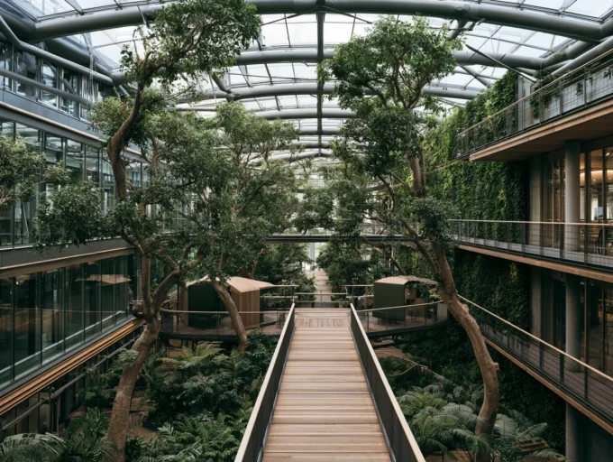
The result is what urban researchers and local residents describe as a “3D city” or “8D Magic City.” Buildings frequently have entrances on multiple floors simultaneously, depending on which hillside road they face. A 30-story residential tower might have ground-level access on its 1st, 12th, and 20th floors at the same time, each connected to a different road at a different elevation. For first-time visitors, the experience is genuinely disorienting: what appears to be a street-level door may open onto a platform suspended 22 stories above the valley floor.
💡 Pro Tip
If you are visiting Chongqing for the first time as an architect or urban designer, resist the urge to rely on Google Maps or standard navigation apps. The city’s vertical layering means that two points that appear close on a 2D map may be separated by 15 floors and a 20-minute climb. Download a local app like Gaode Maps (Amap) and always confirm which floor level your destination is on before you leave.
This vertical complexity emerged not from architectural ambition but from sheer geographic necessity. The terrain was so steep and fragmented that architects and engineers had no choice but to adapt infrastructure to the landscape rather than reshape the landscape to fit infrastructure. Over decades, this pragmatic approach produced an urban environment that architectural theorists have begun studying as a genuinely new model for high-density city building.
📌 Did You Know?
Chongqing’s Rail Transit (CRT) system includes one of the world’s deepest metro stations, with escalators descending approximately 90 meters underground, equivalent to descending a 31-story building. The system currently operates over 500 km of lines across 10 routes, making it one of the most extensive urban rail networks in China according to the Chongqing Rail Transit Corporation’s 2024 annual report.

The Geography Behind Chongqing’s Multi-Level City Design
Understanding china city Chongqing requires understanding its geography first. The city center occupies the narrow Yuzhong Peninsula, where the two rivers meet. This peninsula is surrounded by water on three sides and rises steeply from river level to its highest ridgeline. Urban development had to colonize these steep slopes from the very beginning, and every major infrastructure decision since has been shaped by that original constraint. Parametric Architecture’s analysis of Chongqing’s vertical city logic provides a thorough breakdown of how this geographic pressure shaped the city’s spatial structure.
The Yangtze River and the Jialing River both run at relatively low elevations, but the city’s ridgeline rises dramatically above them. This creates natural “layers” in the urban fabric: a lower level of riverside infrastructure and industrial zones, a mid-level band of dense residential and commercial districts clinging to the slopes, and an upper level of hilltop developments connected by elevated roads and pedestrian bridges. Each layer has its own street grid, its own transit connections, and its own sense of ground level.
For urban planners studying this model, the key insight is that Chongqing’s complexity was not planned centrally. It accumulated organically as successive waves of development adapted to the terrain. Roads were built where the terrain allowed. Buildings were sited wherever foundations could be secured. Transit lines were routed through the paths of least resistance, which sometimes meant tunneling through mountains or threading through the middle of existing residential blocks. Research published in Urban Studies (SAGE Publications, 2024) documents how this organic verticality differs fundamentally from planned vertical urbanism elsewhere.
Chongqing’s Most Iconic Architectural Landmarks
Several specific structures within chongqing cn have become internationally recognized as defining examples of the city’s unique approach to urban design.
Liziba Metro Station
Liziba Station on Chongqing Rail Transit Line 2 is perhaps the most photographed transit structure in the world. The monorail line passes directly through a 19-story residential apartment block, with the station platforms located between the 6th and 8th floors of the building. Residents above and below the station live with trains passing through their building multiple times per hour. The station was designed by Ye Tianyi of Chongqing University and represents the city’s philosophy of weaving infrastructure into existing urban fabric rather than displacing it. It has been cited in numerous urban planning journals as a pioneering example of transit-oriented design adapted to constrained topography.

Raffles City Chongqing
Raffles City Chongqing, completed in 2019, is a mixed-use complex designed by Moshe Safdie of Safdie Architects (via ArchDaily). The project consists of eight towers rising from a shared podium at the confluence of the Yangtze and Jialing rivers, topped by an enclosed horizontal skybridge called “The Crystal” that spans 300 meters and links four of the towers at their upper levels. The Crystal contains restaurants, observation decks, gardens, and public event spaces, creating what is effectively a horizontal skyscraper suspended 250 meters above the ground. The structural engineering was handled by Arup, who developed a mega-frame system capable of withstanding both wind loads and seismic activity. The vertical urbanism concept behind this project shares DNA with strategies explored in our article on Shanghai Tower’s vertical city approach, where a single building is organized as a stack of distinct neighborhoods.
🏗️ Real-World Example
Raffles City Chongqing (Chongqing, 2019): Designed by Safdie Architects and engineered by Arup, this eight-tower complex is connected at its upper levels by The Crystal, a 300-meter enclosed skybridge suspended 250 meters above the Yangtze-Jialing confluence. The project integrates five levels of retail, a rooftop park, and multiple transit connections at different vertical levels, making it one of the most technically complex mixed-use buildings ever constructed in China.
Hongyadong (Hongya Cave)
Hongyadong is an 11-story commercial and cultural complex built along the riverside cliffs of the Jialing River. The complex is constructed on stilt foundations driven into the cliff face, a building technique rooted in the local Tujia and Miao ethnic architectural traditions known as diaojiaolou (stilted buildings). Unlike the sleek towers of Raffles City, Hongyadong references traditional vernacular architecture with wooden balconies, narrow terraces, and layered rooflines. The complex comes alive at night when its entire facade is illuminated, turning the cliff edge into one of the most photographed urban scenes in China. Architectural Digest’s feature on Chongqing describes Hongyadong as one of the clearest examples of the city’s ability to blur the boundary between interior space and cliff-face landscape.

Huangjuewan Interchange
The Huangjuewan Overpass, completed in 2017, is a five-level road interchange with approximately 20 ramps connecting eight different directions of traffic. It stacks road layers on top of one another like a concrete sculpture and is frequently cited as one of the most complex urban interchanges ever built. The interchange manages traffic flows that in a flat city would require dozens of kilometers of grade-separated roads, compressing that function into a relatively small urban footprint. Its visual complexity has made it a social media phenomenon, attracting visitors who come specifically to photograph its layered structure.
How Does the Chongqing Multi-Level City Handle Transportation?
Transportation in the Chongqing multi-level city is itself a multi-layered system. The city operates rail transit lines, elevated highways, underground tunnels, river ferries, cable cars, outdoor escalators, and pedestrian bridges simultaneously, often crossing and intersecting at multiple elevations within a single urban block.
The Chongqing Rail Transit system, as of 2024, consists of more than 500 km of operational lines, with multiple routes tunneling directly through mountain ridges. Line 2 is the most famous internationally because of Liziba Station, but nearly every line in the network includes engineering adaptations to the terrain that would be unusual in any other city. Several stations are located so deep underground that they require multi-stage escalator descents to reach platform level.
The city’s elevated highway network adds another dimension to this complexity. Major expressways cross the city at heights that in other places would be reserved for aircraft approaches, with overpasses rising 50 to 60 meters above valley floors. Beneath these highways, mid-level roads serve local traffic, while pedestrian networks occupy the spaces between, connecting markets, residential entrances, and transit hubs across a vertical range that can span 15 or more stories within a single city block. For a broader view of how sustainable urban infrastructure is reshaping modern cities, our article on ecological boundaries of urban design explores the principles guiding city development in geographically constrained environments.
🔢 Quick Numbers
- 500+ km of operational metro lines across 10 routes (Chongqing Rail Transit Corporation, 2024)
- 32 million people in Chongqing’s total municipal area, making it China’s largest direct-controlled municipality by population (National Bureau of Statistics of China, 2023)
- The Huangjuewan Interchange connects 8 directions of traffic across 5 vertical layers using approximately 20 ramps (Chongqing Municipal Government engineering documentation, 2017)

What Can Architects and Planners Learn from Chongqing City China?
For architecture and urban planning professionals, chongqing city china represents one of the most important real-world laboratories in existence. Several lessons from the city’s development have already begun influencing planning practice internationally.
The first and most transferable lesson is that infrastructure does not need to occupy a single vertical level. In Chongqing, pedestrian networks, transit infrastructure, road networks, and building entrances are distributed across many different vertical positions, with connections between them treated as first-class urban design problems. This multi-level thinking is beginning to influence high-density urban development in cities like Singapore, Hong Kong, and parts of Seoul. The skyscraper design principles emerging from this context are explored in detail in our article on top skyscraper design trends.
The second lesson is that complexity and density can coexist with legibility if residents develop spatial mental models over time. Research in urban geography has documented how Chongqing residents navigate the city using learned vertical landmarks rather than traditional directional orientation. This challenges the assumption that complex urban environments are inherently disorienting and suggests that cities with vertical complexity can be highly functional once inhabitants internalize the spatial logic.
The third lesson is about the relationship between infrastructure and existing urban fabric. Chongqing’s Liziba Station is perhaps the clearest example: rather than demolishing a residential building to route a transit line, engineers routed the transit line through the building itself. This adaptation-first approach is increasingly relevant in dense urban environments where land values and community preservation make demolition-based infrastructure solutions politically and economically untenable.
💡 Pro Tip
Architects designing high-density projects in hilly or topographically constrained urban environments can use Chongqing as a reference for what happens when vertical layering is taken to its logical extreme. Studying the Baixiangju residential complex, where a single building has entrances on the 1st, 8th, and 15th floors connected to different road levels, provides concrete design precedents for multi-access podium and tower typologies that are increasingly relevant in cities like Hong Kong, Medellin, and Lisbon.
Things to Do in Chongqing City: An Architecture Visitor’s Guide
For those planning to visit, things to do in chongqing city extend well beyond standard tourism. The city functions as an open-air architecture and urban planning exhibition. Several specific areas reward close study.
The Yuzhong Peninsula is the historical and administrative core, where the density of vertical layering is highest. Walking the central axis from Jiefangbei (Liberation Monument) down toward the Chaotianmen riverfront reveals the full range of the city’s architectural layers, from narrow alley-level streets buried beneath overpasses to rooftop plazas connected to highway-level pedestrian decks. The Hongyadong complex is at the western edge of this area and provides a concentrated experience of the city’s vernacular cliff-building traditions.
The Nanbin Road area on the south bank of the Yangtze offers some of the best elevated views of Chongqing’s distinctive skyline at night, when the fog that regularly shrouds the city creates atmospheric effects that have drawn comparisons to the visual world of science fiction films. The city’s persistent fog, a result of its enclosed river-valley geography, is also a defining architectural experience: buildings frequently disappear into mist mid-height, making the skyline appear to float. For a broader perspective on how cities globally are approaching density and liveability challenges, our article on sustainable urban living draws on case studies that directly parallel Chongqing’s situation.
The Bai Xiang Ju residential complex, built in 1993 on a slope along the Yangtze, is an important architectural study site. Its six residential blocks rise to the same height above the river but range from 10 to 26 actual stories because of the underlying topography. Multiple bridges connect the blocks at different floor levels, and entrances exist at several vertical points per block. It is one of the clearest physical illustrations of how Chongqing’s residential typology differs from anywhere else.

Hotels in Chongqing City China: Where Architects Stay
Hotels in chongqing city china tend to cluster in the Jiefangbei and Chaotianmen areas of Yuzhong, where proximity to the city’s most architecturally significant landmarks is highest. The upper floors of mid-range and luxury hotels in this area offer views that are unavailable anywhere else in the world: elevated highways threading between residential towers at eye level, monorail lines curving through building facades, and the confluence of two major rivers visible simultaneously from a single window.
For architectural visitors specifically, staying in the Yuzhong Peninsula district maximizes walking access to Hongyadong, Raffles City Chongqing, the Chaotianmen riverfront, and the densest portions of the city’s multi-level pedestrian network. The Jiefangbei area in particular has multiple levels of underground commercial space connected by escalators and pedestrian tunnels, extending the city’s vertical complexity literally below the streets.
Chongqing City Population and Scale
The population of chongqing city china is a number that requires careful interpretation. Chongqing is administratively a direct-controlled municipality, meaning its official boundaries encompass not just the dense urban core but a vast rural hinterland roughly the size of Austria. According to the National Bureau of Statistics of China’s 2023 data, the total municipal population is approximately 32 million, but the urbanized city proper contains approximately 8 to 9 million residents in its dense central districts.
Chongqing city population growth has been rapid since 1997, when the municipality was separated from Sichuan Province and designated as a direct-controlled municipality to anchor economic development in western China. Since then, the city has received enormous infrastructure investment, including major expressway networks, rail transit expansion, and large-scale urban renewal projects in the old industrial zones along the riverbanks. This investment has accelerated the development of the city’s signature vertical infrastructure while simultaneously raising questions about the preservation of older, lower-rise vernacular neighborhoods that give the city much of its character.
✅ Key Takeaways
- Chongqing’s extreme vertical complexity is a direct response to its geography: steep mountain ridges and two converging rivers forced architects and engineers to build upward and adapt infrastructure to terrain rather than flattening it.
- The city’s most iconic structures, including Liziba Station, Raffles City Chongqing, and Hongyadong, each embody a different architectural strategy for operating at multiple vertical levels simultaneously.
- Chongqing’s transit network, spanning over 500 km of rail lines, tunnels through mountains and threads through existing buildings, representing a model of infrastructure integration that is increasingly studied globally.
- For architects and urban planners, Chongqing offers practical precedents for multi-access podium design, vertical pedestrian networks, and transit-oriented development in topographically constrained environments.
- The city’s total municipal population of approximately 32 million makes it one of the largest administrative units in China, but the dense urban core holds roughly 8 to 9 million residents, comparable to London or New York.


Leave a comment